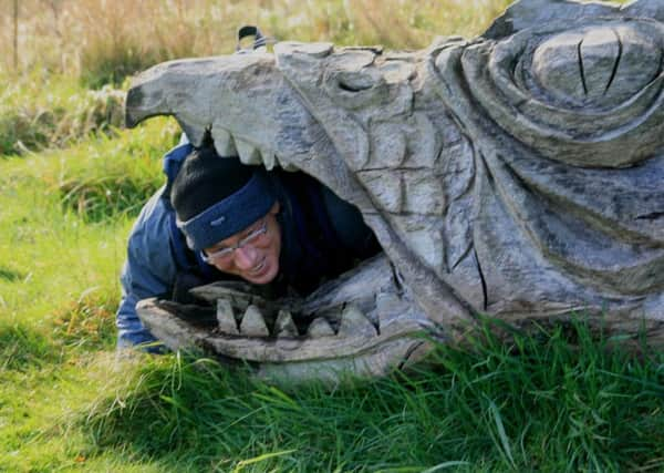
Walking: Beast of a walkabout


• Circular route from and to Bolsterstone Village, Sheffield.
• Meet: Heads Lane, Bolsterstone.
• Park responsibly on roadside up from The Castle Public House, near to St. Mary’s Parish Church.
• Post Code: S36 3ZN.
• Distance: 7.5 miles.
Advertisement
Hide AdAdvertisement
Hide Ad• Graded: Easy to moderate with steep valley incline and descent.
• Grid Ref: SK271968.
Start: From St.Mary’s Church head south, away from the Castle Inn pub, to the junction with More Hall Lane, At the junction, there is a stone stile on the left, climb over the stile and follow the path over high ground across the fields away from the village, where the walker will enjoy a splendid view of the valley below, and the reservoirs of More Hall and Broomhead.
The path continues over another three stone stiles and a wall until it reaches a Farm. The path goes around the back of the farm and over a wooden stile.
Follow the stone wall on your right uphill past another stile and across the fields. Keep walking in this direction until you reach a gate at the far end of the fields which leads to a rough track with tress on the left. Follow this track until you reach a tarmacked road Junction where you should take the left turn up the rough track which rises steeply and is very uneven. Walk straight on and then drop down as the track continues along the higher ground. You should pass through two metal gates where the path forks off to the right, downhill through another gate before continuing along a path with stone wall sides. Continue through another gate downhill through the woods and you should pass a sign on the left ‘Ministry of Defence Authorised Firing Range’.
Advertisement
Hide AdAdvertisement
Hide AdAt the end of the descent through the woods you reach the Wantley Dragon Sculpture where an info board tells you all about the legend and a viewpoint over the valley below.
Continue along the main path as it drops down onto another track and then onto More Hall Lane. Turn left and go down More Hall Lane for 400 metres and exit the gate where you will see the extremely busy A6102.
The sight line in both directions is restricted and the walker should exercise extreme care here. Immediately cut back sharp right through the large gateway onto Yorkshire Water property. Continue up the road to the dam wall (750 m). Turning left, go through the metal gate and cross the dam wall, keeping Morehall reservoir on your right. At the end of the dam wall, turn right and follow the path by the side of the reservoir until it opens out onto New Mill Bank.
When you reach New Mill Bank, turn left for 100 m, then take the bridleway on your right into ‘Horse Wood. After a gentle ascent, continue to follow this path along the southern side of Broomhead Reservoir. When the path meets New Road go through the gap in the fence on your right (18) and, turning left,continue along the permissive path towards the top of the reservoir.At the western end of the reservoir the path opens onto Yew Trees Lane. Do not exit at this point, but continue to follow the path through the woods on the shore of the reservoir. Exit the shoreline via a gate which leads out onto the road, at which point turn right.
Advertisement
Hide AdAdvertisement
Hide AdThis is a main road and traffic can be moving quickly. Cross the road bridge which is 10 m in front of you and then take the signed footpath to the left about 25 m after the bridge, into Yew Trees Lane Wood . Initially this path runs parallel to the river, but soon turns right away from it. Follow the path as it climbs up towards the woods. The path runs parallel to the road, passing between a dry- stone wall and a fence.
When you reach the woods, follow the path which initially runs parallel to the wire mesh fence. This slowly rises up through the woods. After 200 m, the path veers to the left and continues to ascend through the wood, gradually becoming steeper nearer to the summit.
At the top of the woods go over the wooden stile into the field.Cross the field to the wall opposite the stile and then follow the wall up the hill, passing over a stone stile, to the farm buildings.
Go up through the farm yard and through the small gate on your right then take the path up the bank on the left up to Heads Lane. Turn right onto Heads Lane and follow the lane back to Bolsterstone, passing the church on your left. This marks the completion of the walk itself.
Advertisement
Hide AdAdvertisement
Hide AdThis walks was written, walked and produced by Chris Greig and Allison Glossop of Deane Valley Ramblers, why not join them on their next walk, Eyam Plague Circular on Sunday, 1 April. A walk with magnificent views around the historic village of Eyam, remembered for the courage with which its inhabitants dealt with an outbreak of the plague which ravaged Britain in the 1660s. After the walk St Lawrence Church, Eyam Hall (NT), craft shops in its courtyard and the museum are all open until 4.30pm. Starting point: Outside toilet block of pay & display car park opposite Eyam museum on Hawkhill Road, Eyam. Grid reference: SK217767. Nearest postcode: S32 5QP Start time: 10:00. Contact details: John and Audrey Wright/01709 524243 or 07598316783.